By Robin Hartman
Kentucky Energy and Environment Cabinet’s (EEC) drone team is soaring to new heights, finding new uses for unmanned aerial vehicles (UAVs) seemingly each month. Made up of pilots from the divisions of waste management, water and abandoned mine lands, the team recently showcased their drones at a showing for fellow #TeamEEC members.
The drones are now used by nearly all cabinet divisions: The team flies over every contained landfill in the state annually to make sure requirements are met, and regularly uses them for other hazardous waste sites where access is difficult. Most recently, they are to document the installation of underground storage tanks (UST) and piping using GPS coordinates. This allows for a much more exact location and schematic of the UST systems than contractor sketch drawings, and allows for easier access (or avoidance) if needed in the future.
The Division of Water has found numerous uses for UAVs, from conducting dam inspections to locating water leaks to measuring wetlands and taking water samples. In early 2020, the teamperformed a bathymetric study — a measure of a water body’s depth and underwater features — of the Olive Hill Reservoir in Carter County and of the Curtis Crum Reservoir in Martin County, taking detailed data with an unmanned surface catamaran, or “drone boat” to determine capacity.
Infrared and near-infrared cameras and thermal sensors attached to the drones can help identify natural springs and water leaks, harmful algal blooms and drought conditions. Likewise, the same equipment can detect hotspots underground, as was the case recently when a landfill caught fire in Louisville.

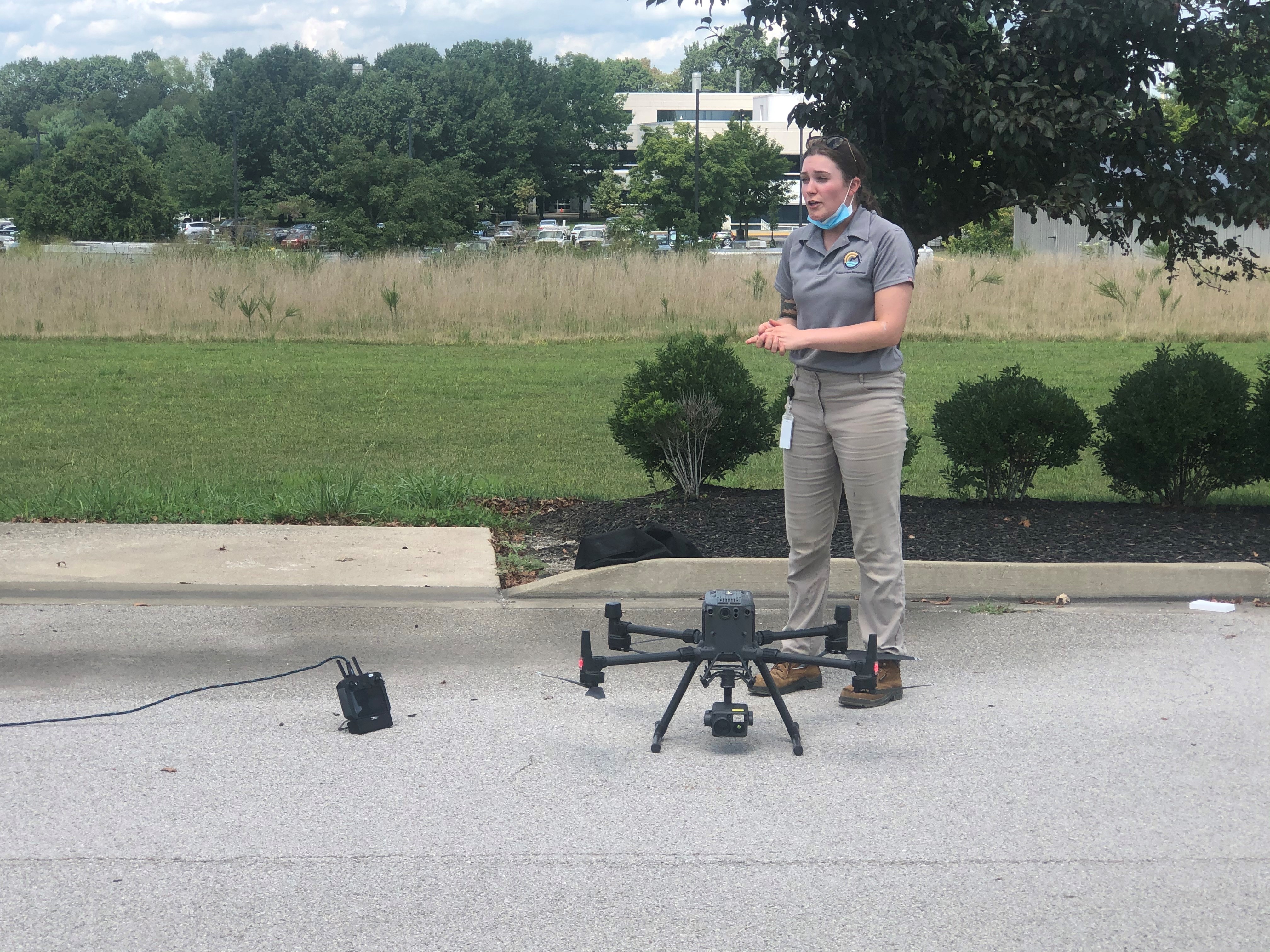
Right to Left: Department of Environmental Protection Deputy Commissioner Amanda Lefevre, tries her hand at flying a drone. Sarah Hettel, Division of Waste Management’s drone program coordinator, explains the functions of one of the division’s drones prior to flight. Photo by Robin Hartman.
The Division of Forestry has found UAVs helpful in species identification and in locating areas where threatened trees such as Hemlocks may need attention.
The cabinet’s Emergency Response Team, as well as the Division of Abandoned Mine Lands have long utilized drones to monitor emergency situations, including a train derailment in Pike County in 2020 and landslides or fires.
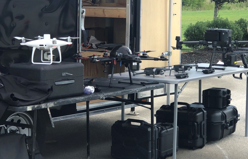
Specs and Capabilities
Three drones were on display at a recent demonstration at the 300 Building. The DJI Mavic Pro 2, with a five-mile travel range, can reach a speed of up to 45 mph and a height of 1,640 feet. The drone can produce images with a resolution of 20 million pixels.
The DJI Matrice 300 RTK can travel up to 51 mph and go 9.3 miles and 2,195 feet in the air. This UAV has an infrared camera, a 20x zoom lens and range-finding capabilities of up to three-quarters of a mile.
The DJI Phantom 4 RTK Multispectral drone has a six-sensor camera that can capture images that can then be analyzed to determine such things as soil moisture, plant health and growth of Harmful Algal Blooms (HABs) in our lakes and streams.
“The list of things we can accomplish with drones continues to grow,” said Sarah Hettel, Division of Waste Management’s drone program coordinator. “We can inspect a vast area in a short amount of time, saving time and energy for our inspectors. We can protect our inspectors from entering dangerous areas or areas with difficult terrain. And we can harvest data that will be useful to the cabinet and ultimately, the people of the Commonwealth.

For additional details on the Energy and Environment Cabinet’s drone program, read EEC’s Innovative Drone Use Promotes Efficiency, Worker Safety.
Categories: Abandoned Mine Lands, All, Division of Mine Safety, Featured, Forestry, Media Gallery