By Sheri Uhlenbruch
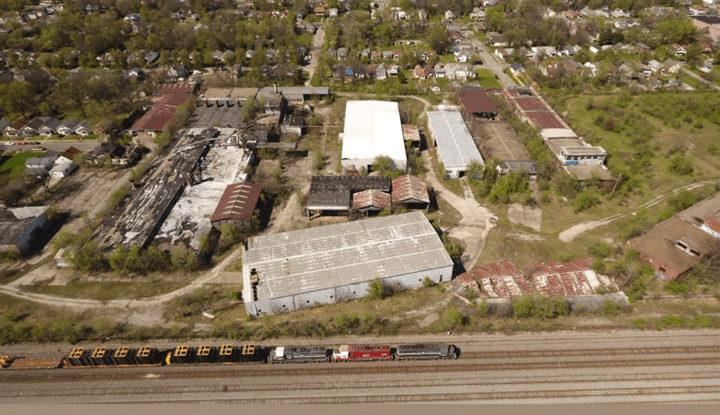
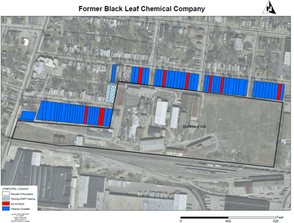
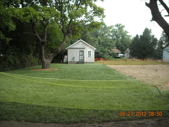
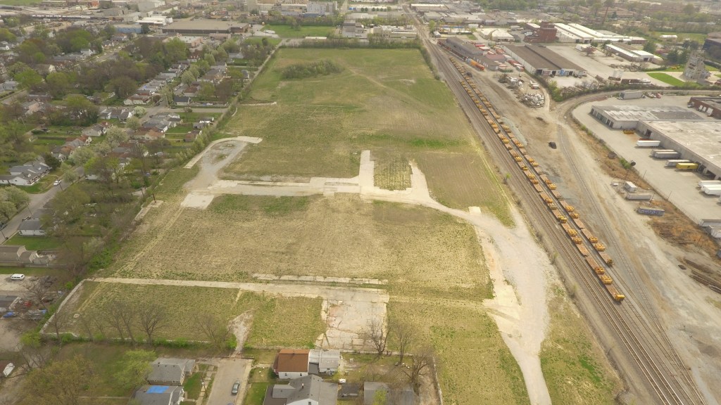
In 2010, the Kentucky Department of Environmental Protection began the state’s largest and most expensive urban residential cleanup of toxic chemicals to date. Elevated concentrations of pesticides and PAHs — polycyclic aromatic hydrocarbons — had been detected in the soil around the former Black Leaf Chemical site in Louisville.
As KDEP worked with the U.S. EPA to plan for the removal of contaminated soil, its members recognized that without having a “background” data set, or general baseline concentrations of PAHs for the city, it was difficult to determine how much of the contamination was from the site or was a product of its urban setting. So, the cleanup was guided by general screening concentrations for residential properties.
KDEP compiled information about the background levels of PAHs in Kentucky’s urban soil as cleanup of the Black Leaf site progressed, with the goal of improving site-specific calculations for future cleanups. In 2014, KDEP submitted a research proposal to the U.S. EPA Region 4, which represents the southeastern states, to document the existing condition of Kentucky’s urban environments.
EPA Region 4 liked the idea so much that the scope of the study grew, and the agency encouraged other states to get involved.
“EPA recognized that the need to understand urban background was not solely an issue in Kentucky,” EPA Region 4 Scientific Support Section Chief Tim Frederick said. “… It is important for investigators to know what urban background concentrations of contaminants are in order to conduct the investigation of sites suspected of being contaminated and the accompanying risks it may present.”
The ongoing effort could lead to more efficient cleanup of contaminant spills — both in the Commonwealth and throughout the nation — and has the potential to create a first-of-its-kind national urban background data set in the future.
The Importance of Urban Background Studies
Decades of human activity have contributed to an increase of certain chemical compounds in the environment. For example, PAHs are “everywhere in a modern society,” KDEP Environmental Scientist Consultant Larry Hughes said.
“Some of them are natural, like in coal areas. Some of them are just due to modern society. We burn fuels. We grill hot dogs. We use petro-chemicals. They are everywhere, but they have to be in certain concentrations to be where they increase your risk of anything.”
So when site investigators are evaluating a site with high concentrations of PAHs, it can be difficult to differentiate between a site’s activity and the effect of an urban setting.
“When you’re looking at a release from a regulatory point of view, you’re only concerned with what somebody released,” Hughes said “They shouldn’t be responsible for something that’s everywhere we’re walking.”
Urban background data has a number of applications — such as site evaluations for emergency response, superfund listing and other types of environmental investigations — but collecting samples of urban soils to develop an accurate urban background data set can be difficult, Frederick said.
“Soils in urban environments have typically been graded, filled, and otherwise reworked for development,” he said. “That can lead to variability between sample locations and differences between the native soils and the developed soils.”
Limited resources can also be an issue, Frederick said, because a robust group of samples is needed to represent the urban background conditions.
Testing the Soil
The research project received $180,000 in funding from EPA’s Regional Applied Research Effort (RARE) program to conduct the research, which both agencies believed could be useful in advancing remedial work in Kentucky and throughout the region. EPA Region 4 Superfund program also allotted additional funding to support project completion.
EPA, KDEP and the other states in Region 4 used the funding to develop the sampling and analytical approach that would be used to sample soils from areas in each of the selected cities. KDEP drafted the study with two goals in mind: They wanted agencies in other regions to be able to apply the study methods for their own measurements, and they wanted the results to be comparable across states.
“This was an excellent project that fostered collaboration between EPA and the governments of eight states and eight cities,” Frederick said.
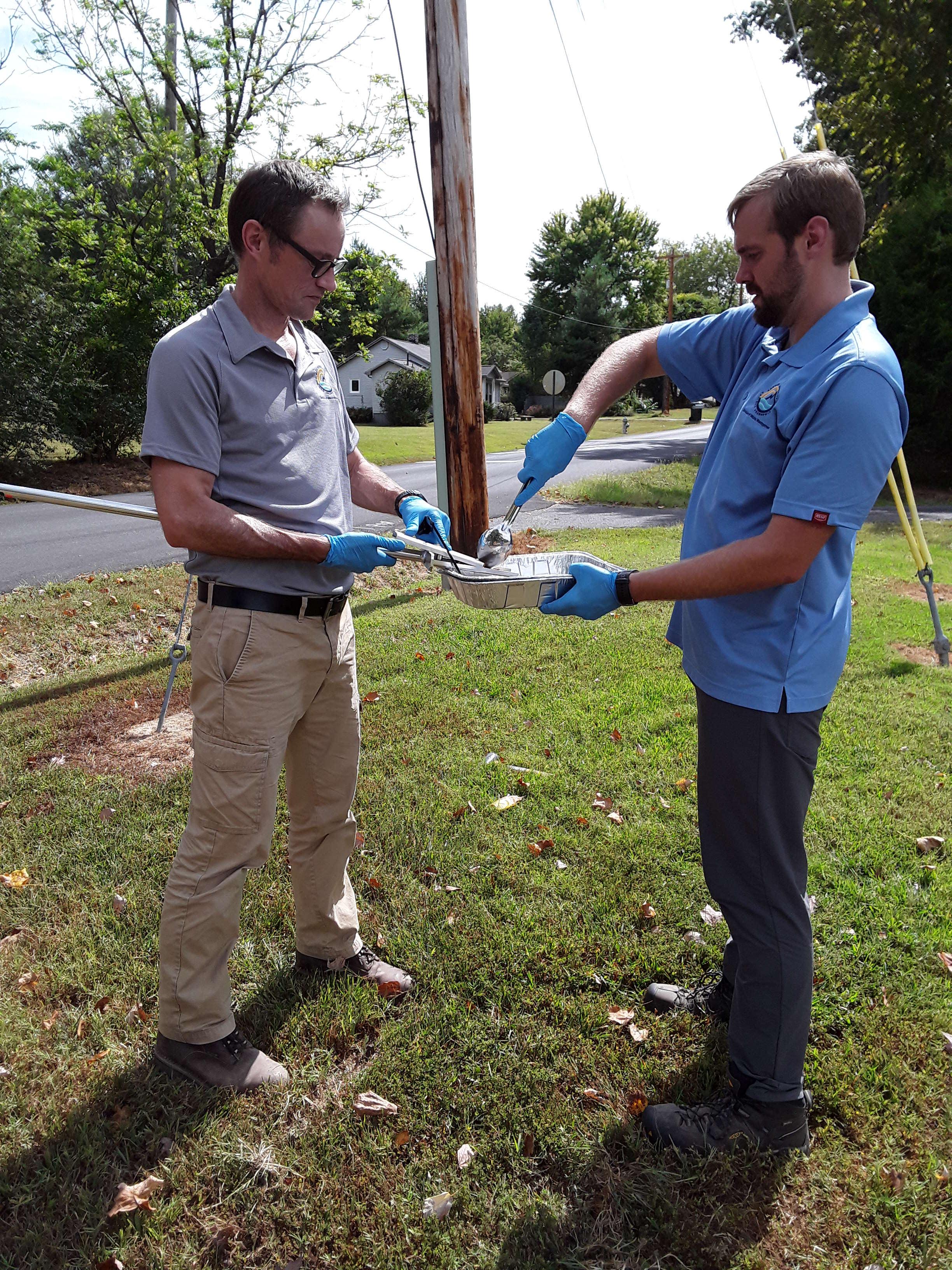
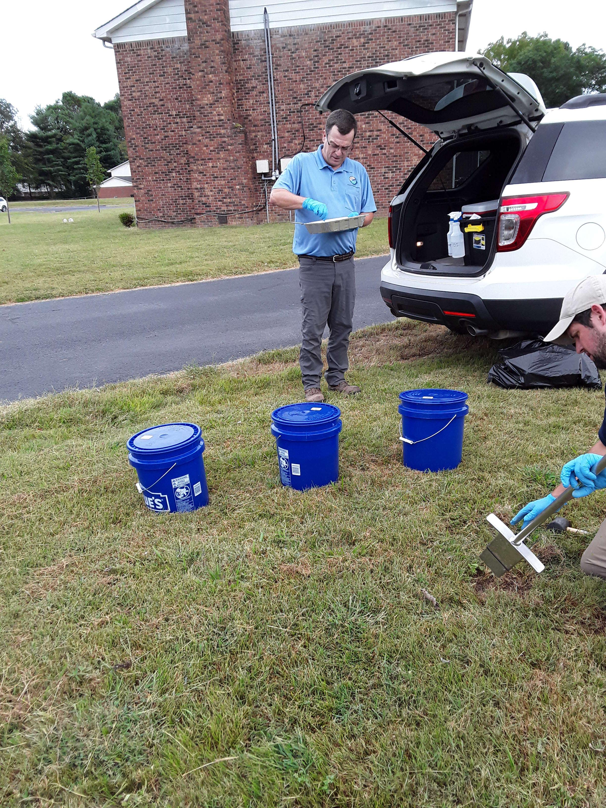
KDEP personnel processing and taking soil samples during cleanup. Photos courtesy of KDEP.
Seven of the eight states in Region 4 decided to participate, with each state selecting two cities to sample. For example, KDEP suggested Lexington and Louisville for the Region 4 study, based on population, size and historic land use.
In April 2020, U.S. EPA Region 4 published the Urban Background study, which included the results of soil analysis from sites in Louisville and Lexington. The results showed that in general, urban concentrations are elevated when compared against a U.S. Geological Survey study of rural concentrations. However, the urban sample results are generally still below EPA recommended Residential Screening Levels.
“We were expecting the numbers to be more elevated in Louisville,” Hughes said. “We were kind of surprised to find they weren’t quite as elevated. They were rather low, (and) that’s good for obvious reasons.”
The EPA recognized the study in September with a 2020 Notable National Achievement Award. Other regions, including those representing New England and the Pacific Southwest, have shown interest in participating in similar studies using the methodology developed by Region 4 and the partner states.
In addition, the University of Florida has used the methodology developed by the team to sample two additional cities, Frederick said, and two other universities — University of Memphis, Vanderbilt University — have used the data from the original study to support their environmental research efforts.
At the same time the Region 4 study was underway, KDEP decided to sample additional cities in Kentucky with the hope that this additional data would lead to a broader understanding of urban soils across the state’s geologically and geographically diverse cities.
So far, scientists from the Superfund Branch have taken samples have in Lexington, Louisville, Ashland, Owensboro, and Paducah. Final data collection in Somerset, Bowling Green, and Pikeville are pending, but on hold due to COVID-19.
For scientists within DEP, sound decisions are best made when the data supports it. So, digging — literally — for the truth will continue.
+++
About the Author
Sheri Uhlenbruch is a registered geologist in Kentucky’s Superfund Branch whose work includes remediating waste-impacted sites and working with Brownfields properties. Uhlenbruch oversaw KDEP’s drafting of the Urban Background Study. As a supervisor in the Superfund Branch, she saw opportunities to improve data related to urban backgrounds and to devise ways to better use science to support policy. In her past eight years as the branch’s Environmental Scientist Consultant, she has focused on research and developed projects that improve processflow, fill data gaps, and update policy. The Urban Background Study is a result of these efforts.